The Beginning
In 1966 the CIA awarded the design and fabrication of the future Hexagon spy satellite to us at the Perkin-Elmer Corporation in Danbury, CT. Its purpose was to map the entire landmass of the earth and to photograph military assets of our cold war opponents. This was to result in stereo photos with the ability to see objects as small as 2 to 3 feet in size from an altitude of 100 miles. This resolution would surpass the best previous satellite photographs by a factor of at least 4. It would turn out to be a huge success and be the last film based reconnaissance satellite. All future ones would be digital and have the ability to transmit its photos almost immediately after photography. The drawing below shows a conceptual view of the satellite vehicle and was drawn by Giuseppe De Chiarra, a clever Italian engineer.
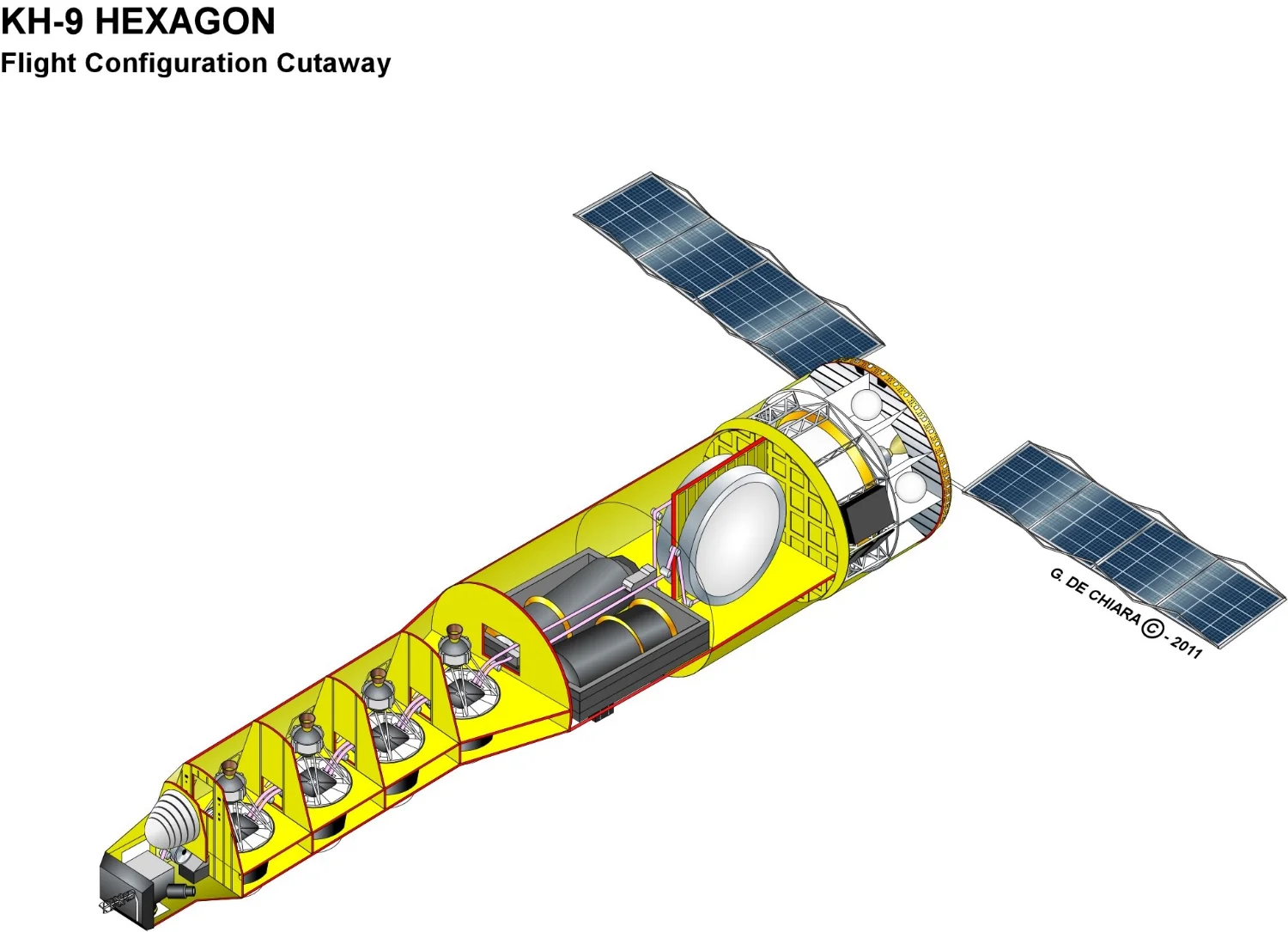
Hexagon Isometric Drawing